Sierra de Guadarrama, Madrid, Spain
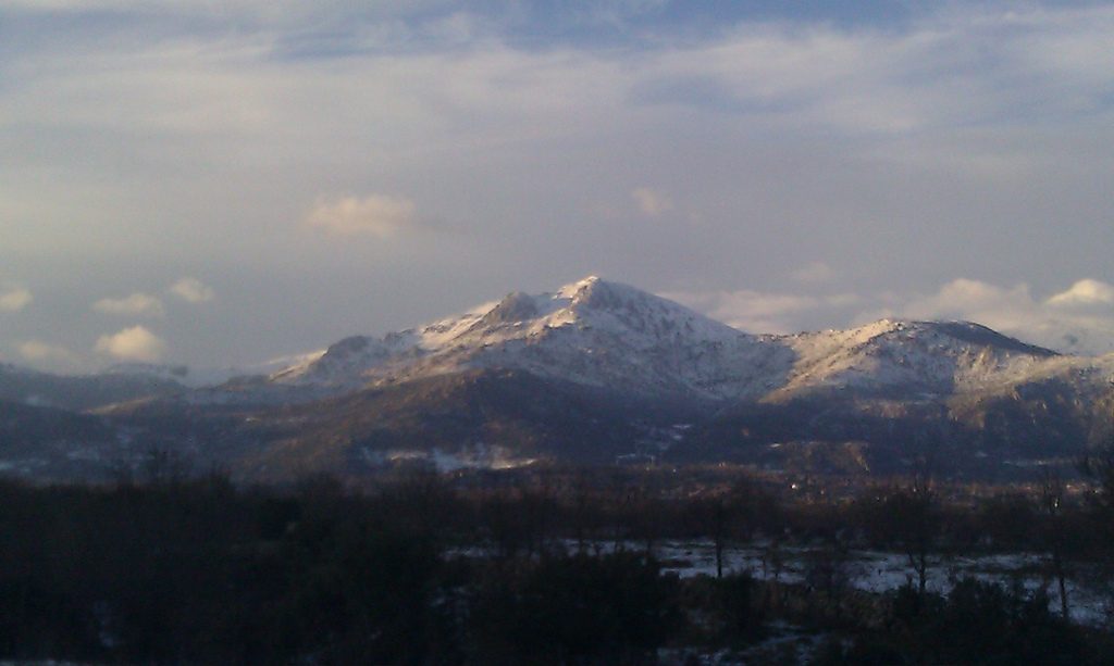
The Sierra de Guadarrama is the mountain range that closes the horizon north-west of Madrid and separates the Madrid region from the province of Segovia. Since 2013 its highest ground has been a national park. This post describes the range and the park, the areas most visited from Madrid, how to reach them by public transport, and the access rules and limits that apply in 2026.
The range and the national park
The Sierra de Guadarrama is part of the Sistema Central, a mountain chain about 500 kilometres long that crosses the centre of the Iberian Peninsula from east to west. Spain’s ministry for the environment describes it as cooler and wetter than the plateaus on either side and less altered by human activity, which has made it a refuge for biodiversity. Its glacial cirques and lakes, its granite crags and its large Scots pine forests are the features the ministry singles out.
The Parque Nacional de la Sierra de Guadarrama was declared by Law 7/2013 of 25 June. It covers 33,960 hectares: 21,714 in the Madrid region and 12,246 in Castile and León. Some of its landscapes had been protected long before, as Peñalara, La Pedriza and the Pinar de la Acebeda were declared natural sites of national interest in the 1930s. The park has summits above 2,000 metres. The highest is Peñalara, the highest point of both the Madrid region and the province of Segovia.
Landscape and wildlife
Pine forests and some stands of oak cover the slopes. Nearer the summits they give way to high-mountain scrub of broom and juniper, and in spring the mountain meadows fill with flowers. According to Spain’s official tourism website, the Iberian wolf has returned to these mountains, and roe deer and red deer are also present. Golden eagles and black vultures fly over the high ground; the park monitors a colony of black vultures. The wetter areas hold amphibians and reptiles such as the Iberian frog and rock lizards.
Areas to visit
- Peñalara and Puerto de Los Cotos. The massif has the best glacial remains of the range and high-mountain ecosystems. The Peñalara visitor centre stands at the pass, at km 42 of the M-604 road in the municipality of Rascafría, and is open every day of the year from 8:00 to 18:00. The car park is free, has 250 spaces and closes only when full. At weekends and on public holidays it usually fills between 9:00 and 11:00, and earlier when there is snow. A daily visitor limit applies to the massif and is occasionally reached.
- La Pedriza. A large area of granite domes and boulders above Manzanares el Real, popular with walkers and climbers. The visitor centre is open every day from 9:00 to 15:00, except on 1 and 6 January and 24, 25 and 31 December. Car access to the Canto Cochino car park is limited to 270 vehicles. In winter (1 October to 31 May) the road is closed to motor vehicles on Saturdays, Sundays and public holidays from 10:30 to 16:00; on those days the car park is usually full by 8:30 to 9:00.
- Valle de la Fuenfría. A valley of Scots pine forest above Cercedilla, with a wide network of marked paths. The visitor centre is at km 2 of the Las Dehesas road and opens daily from 9:00 to 19:00 between April and October and from 9:00 to 16:30 in the other months.
- Valsaín and El Paular. The Valsaín valley on the Segovia side and the El Paular valley near Rascafría each have a visitor centre.
Around the park, the monastery of El Escorial is about half an hour away, and the Royal Palace of La Granja de San Ildefonso lies on the northern side of the range in Segovia.
Getting there from Madrid
By car the park is about one hour from the city. Public transport reaches the main entry points:
- Los Cotos and Peñalara: bus 691 from the Moncloa interchange in Madrid towards Valdesquí. Lines 692 and 819 run only at weekends and on public holidays.
- Cercedilla and La Fuenfría: Cercanías line C8 (Guadalajara–Madrid–Cercedilla).
- La Pedriza: bus 724 from the Plaza de Castilla interchange to Manzanares el Real, then about 15 minutes on foot to the visitor centre.
The mountain railway C9 from Cercedilla to Puerto de Navacerrada and Los Cotos has been closed since May 2024 for renovation of the line, according to the Peñalara visitor centre page. A replacement bus covers the route. It is worth checking the current state of the line before planning a trip around it.
Rules and safety
- Camping with a tent is not allowed anywhere in the mountains of the Madrid region, including the national park.
- Bathing in the lakes, pools and streams of Peñalara is not permitted.
- Groups of 15 or more need prior authorisation to walk in the Peñalara massif.
- Pets must be kept on a lead.
- No area of the park is set aside for sledging, and no equipment such as crampons, poles or skis can be hired at Los Cotos.
The weather changes quickly at altitude. The tourism website advises clothing for rain and cold and proper footwear. Besides walking, there are twenty cycling routes, and when snow conditions allow, ski touring, cross-country skiing and snowshoeing are practised around Peñalara. The national park website publishes current conditions, access notices and a programme of guided walks.
For students
The Sierra is the standard day out for students in Madrid and Segovia: entry to the park is free, and buses and local trains reach the trailheads. Arriving early, or on a weekday, avoids the vehicle limits. More on the area is in the posts on Puerto de Navacerrada and on studying in Madrid.
More about: Madrid · All blog posts